
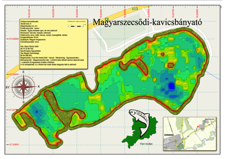
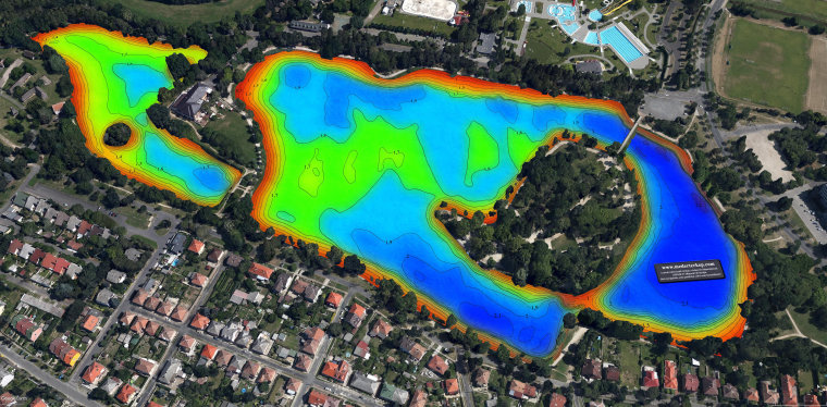
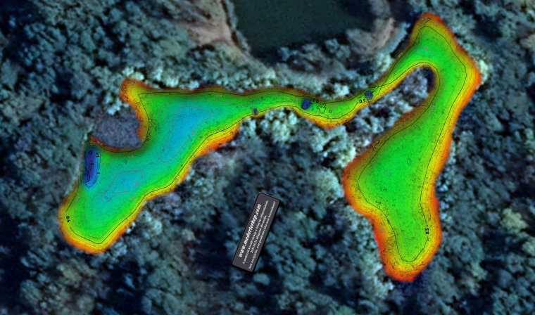
Riverbed maps
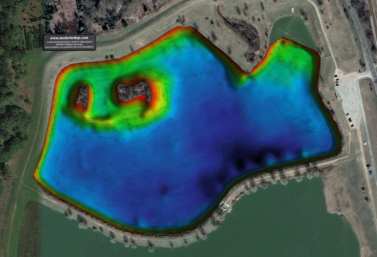
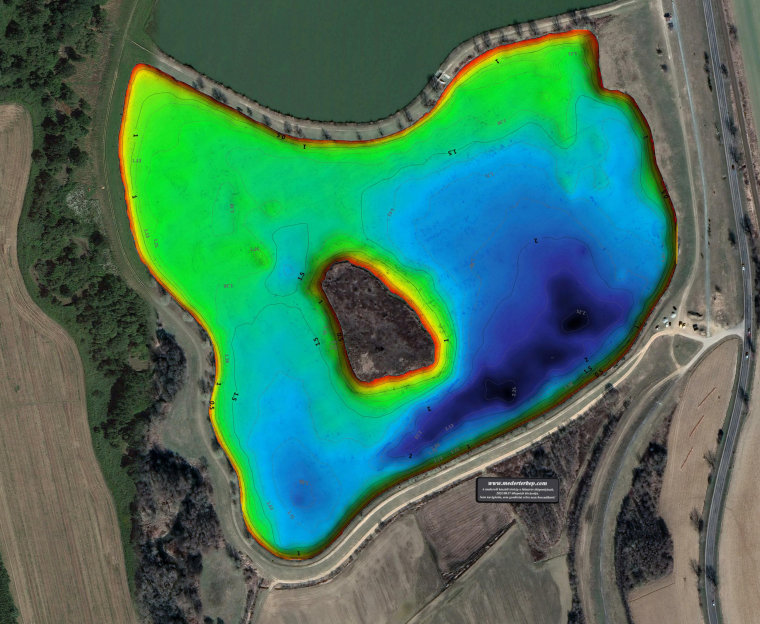
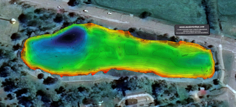
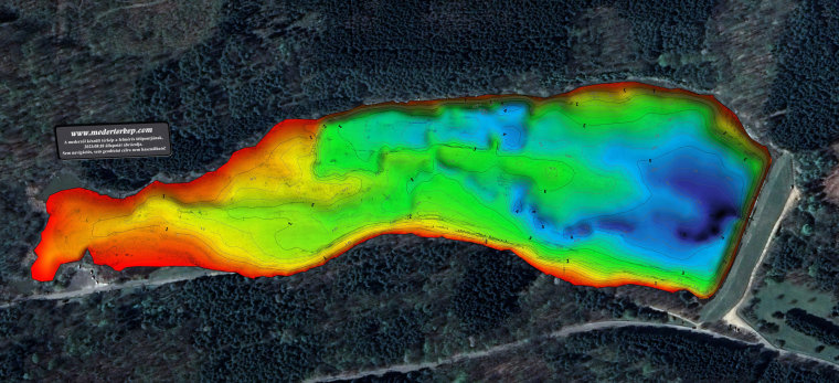
The depth and contours of the riverbed are illustrated by a map with a coordinate grid. The completed riverbed maps have also been placed on the affected waterfronts, and we will also publish them here in digital form.
With the help of the complex measurement system, we get a perfect picture of the lake in terms of bed depth.
Magyarszecsődi gravel pit lake
Lukácsházi Abért I Lake
Lake Lukácsházi Abért II
Video presentation of the Lukácsházi Open Lakes:
Lake Celldömölk
Video presentation of Lake Celldömölk:
Csepreg Brick Factory Lake

Lake Hársas in Máriaújfalu
Video presentation of Lake Hársas in Máriaújfalu:
Szombathely Boating and Fishing Lake
Vasvár boating lake
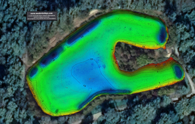
Vasvári Lake II
Vasvár Lakes video presentation:
Kerkafalvi Kéhatár Lake bed map video:
Further information about riverbed mapping is available at www.mederterkep.com .